
Materi:
- Klasifikasi untuk analisis Land Use dan Land Cover di QGIS
- Klasifikasi untuk analisis Land Use dan Land Cover dengan Google Earth Engine
Software yang digunakan:
- QGIS
- Orfeo Toolbox
- Google Earth Engine
Langkah-langkah:
- Install QGIS
Sign in to Google Earth Engine
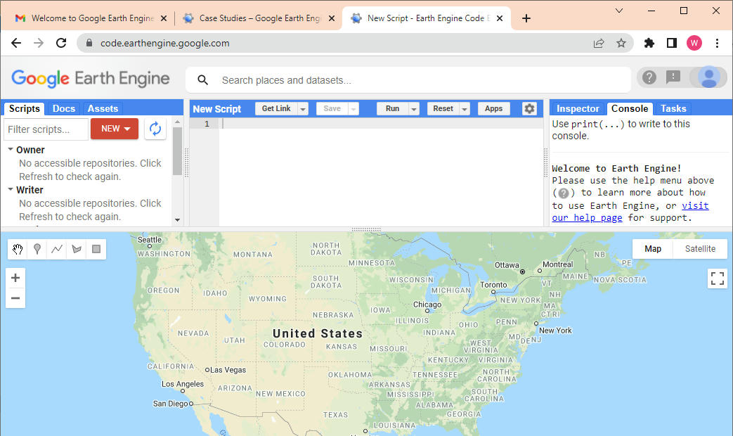
- Sign in to Google Earth Engine, klik sign up untuk pertama kali
- Setelah suskes sign up, selanjutnya lakukan sign in, dan coba masuk ke halaman Platform -> Code Editor
- sd
Tambahkan Orfeo Toolbox di QGIS
- Untuk membaca langkah-langkah download dan menambahkan Orfeo Toolbox, silahkan download ebook disini
- Download Orfeo Toolbox, klik https://www.orfeo-toolbox.org/download/
- Unzip file hasil download di C, misal C:\OTB-7.0.0-Win64 dimana folder ini memuat Library Orfeo.
- Selanjutnya download folder lain yang memuat file configurasi Orfeo Plugin di QGIS. Download zip folder di https://gitlab.orfeo-toolbox.org/orfeotoolbox/qgis-otb-plugin dan unpack it.
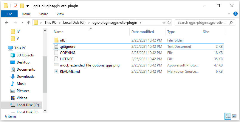
- Buat folderdi drive C:\qgis-plugins\qgis-otb-plugIn and copy semua file hasil download diatas, sehingga seperti ini.
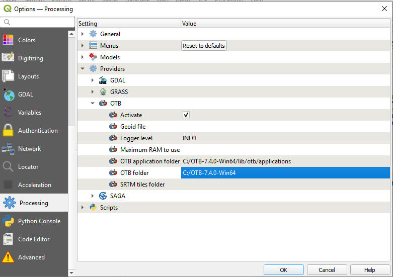
- Selanjutnya buka QGIS, lalu pilih menu Settings -> Options. Selanjutnya pilih menu Processing -> Providers lalu pilih OTB. Set OTB application folder dengan C:\OTB-7.4.0-Win64\lib\otb\applications dan OTB folder dengan C:\OTB-7.4.0-Win64 lalu klik OK.
- Maka Orfeo Toolbox siap digunakan di QGIS.
Analisis supervised dengan Orfeo Toolbox di QGIS, tahapan yang akan dilakukan adalah:
- Melakukan analisis Unsupervise (K-means) dengan OTB di QGIS.
- Menggunakan Random Forest, SVM, dan Decission Tree di QGIS.
- Melakukan performasi assesment akurasi dan compute main accuracy measures.
Analysis di GEE:
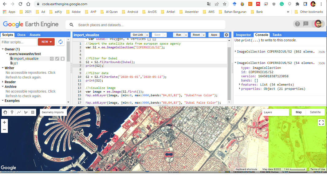
- Import dan visualisasi Sentinel image di GEE
//import the satellite data from european space agencyvar S2 = ee.ImageCollection("COPERNICUS/S2");//filter for DubaiS2 = S2.filterBounds(Dubai);print(S2);//filter dateS2 = S2.filterDate("2020-01-01","2020-05-11");print(S2);//visualize imagevar image = ee.Image(S2.first());Map.addLayer(image, {min:0, max:3000,bands:"B4,B3,B2"}, "DubaiTrue Color");Map.addLayer(image, {min:0, max:3000,bands:"B8,B4,B3"}, "Dubai False Color");
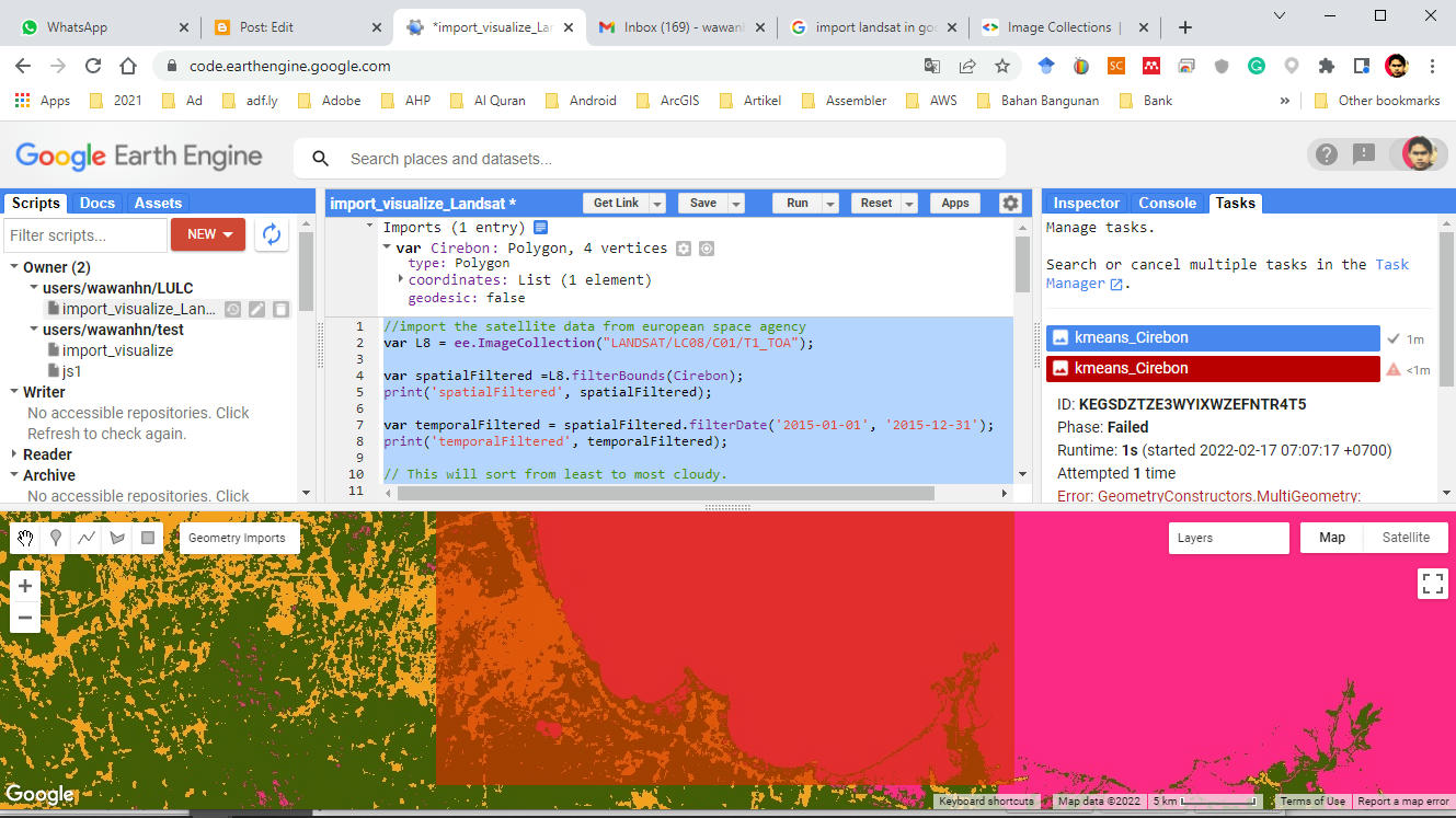
- Import dan Visualisasi Citra Landsat 8 di GEE
//import the satellite data from european space agencyvar L8 = ee.ImageCollection("LANDSAT/LC08/C01/T1_TOA");var spatialFiltered =L8.filterBounds(Cirebon);print('spatialFiltered', spatialFiltered);var temporalFiltered = spatialFiltered.filterDate('2015-01-01', '2015-12-31');print('temporalFiltered', temporalFiltered);// This will sort from least to most cloudy.var sorted = temporalFiltered.sort('CLOUD_COVER');// Get the first (least cloudy) image.var scene = sorted.first();Map.centerObject(scene, 9);Map.addLayer(scene, {}, 'default RGB');var visParams = {bands: ['B4', 'B3', 'B2'], max: 0.3};Map.addLayer(scene, visParams, 'true-color composite');//Create training datasetvar training = scene.sample({ region : Cirebon,scale : 20,numPixels : 5000});//Start Unsupervised clustering algorithm and training itvar kmeans = ee.Clusterer.wekaKMeans(3).train(training);//Cluster the input using the trained clusterer.var result = scene.cluster(kmeans);//Display the cluster with random colorsMap.addLayer(result.randomVisualizer(),{}, "Unsupervised kmeans classification");//Export the Image to DriveExport.image.toDrive({image :result,description : 'kmeans Cirebon',scale : 20,region : Cirebon});
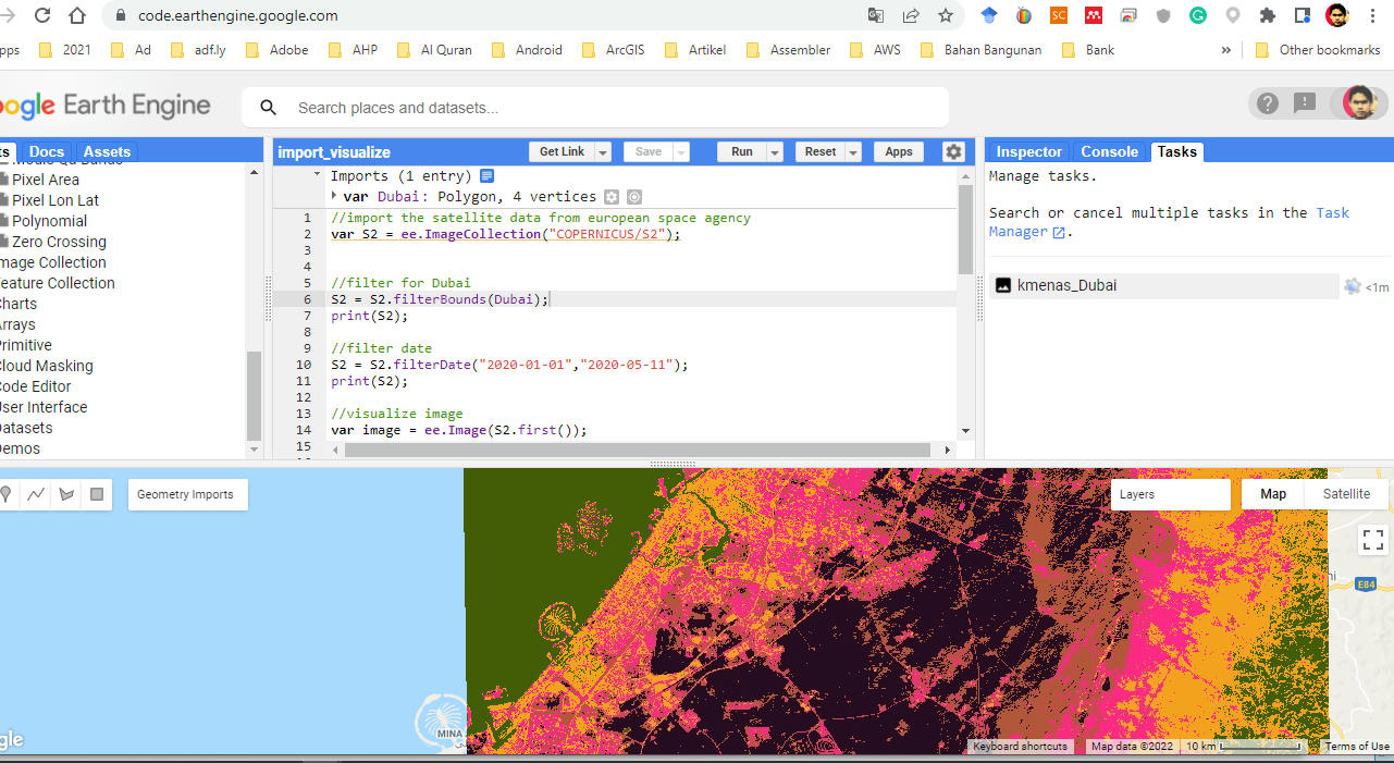
- Unsupervised analysis di GEE
//import the satellite data from european space agencyvar S2 = ee.ImageCollection("COPERNICUS/S2");//filter for DubaiS2 = S2.filterBounds(Dubai);print(S2);//filter dateS2 = S2.filterDate("2020-01-01","2020-05-11");print(S2);//visualize imagevar image = ee.Image(S2.first());//Map.addLayer(image, {min:0, max:3000,bands:"B4,B3,B2"}, "DubaiTrue Color");Map.addLayer(image, {min:0, max:3000,bands:"B8,B4,B3"}, "Dubai False Color");//Create training datasetvar training =image.sample({ region : Dubai,scale : 20,numPixels : 5000});//Start Unsupervised clustering algorithm and training itvar kmeans = ee.Clusterer.wekaKMeans(5).train(training);//Cluster the input using the trained clusterer.var result = image.cluster(kmeans);//Display the cluster with random colorsMap.addLayer(result.randomVisualizer(),{}, "Unsupervised kmeans classification");//Export the Image to DriveExport.image.toDrive({image :result,description : 'kmenas Dubai',scale : 20,region : Dubai});
- Supervised analysis di GEE


0 comments:
Post a Comment